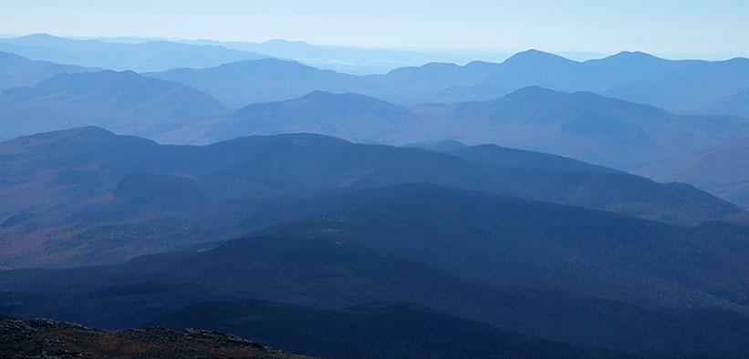
White Mountain Panorama
My brother, two of my nephews and I climbed Mt.
Washington on Columbus Day weekend (October 6-9) 2006. Mt. Washington is famous
for its horrible and dangerous weather, which is undoubtedly justified but we
experienced an absolutely glorious fall weekend. After weeks of weather
forecasts threatening snow and cold, the weather was magnificently beautiful.
Aside from the exertion involved, there’s no better way to see the fall foliage
in New England. On the day of our climb, the peak observatory recorded a record
high of 57 degrees. Some local denizen along the trail told us this was the best
weather in the last four months.
We set out from Boston on at about 7:00 AM all of us and our gear crammed into
in a car and arrived at Pinkham Notch NH, the AMC headquarters for the region,
at around 10:30 AM.
We were hoping to get 4 spots in the Hermit Lake Shelter at the base of
Tuckerman’s Ravine for that evening (first come, first served) but when we arrived we were told that all
100 spots had been taken by 6:30 AM that morning, with 100 others being turned
away.
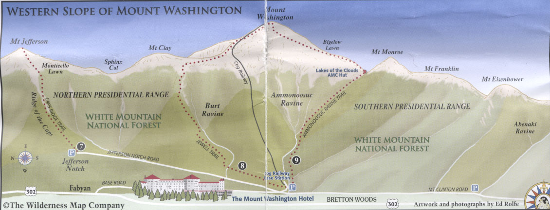
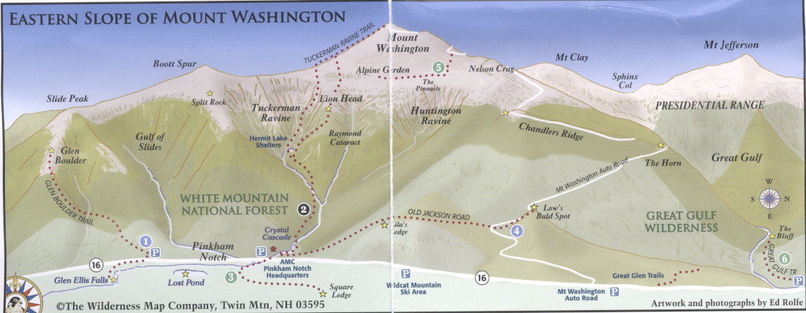
So we consulted with the AMC volunteers who suggested that we go up the Old
Jackson Road and set up our tents off the east side of the trail on an area that
is sort of a plateau. So 1 ½ hours and 515 calories later we were bushwhacking
through dense foliage until we found a mossy clearing which we widened by moving
dead branches and uprooting little saplings until we had room for our
tents not far from a gurgling stream.
After we had set up camp, we hiked another hour or so to a rocky outcropping
called Low’s Bald Spot, where we had a great view of the valley behind us, Mt.
Washington to our left and the pyramid peak of Mt. Jefferson directly ahead.
From Mt. Washington we could occasionally see sunlight glinting off windshields
of cars descending the auto road hidden in the trees and hear the whistle of the cog railway
descending the opposite side. A glider was swooping into and out of a big ravine
just below the peak of Mt. Jefferson. A great place to sit for a couple of
hours; I slept for much of it, stretched out on the granite in the sun.
At around 6:30 PM or so we tramped back to our hidden campsite and turned
in after munching on Trail Mix and whatnot (read the label of this supposedly PC
food sometime: saturated fat, sodium, trans fat galore!).
-----------------------------------
We were up at 5:15 AM the next day, broke camp and hiked back down to
Pinkham’s Notch for a 6:30 AM breakfast in the visitor’s center which is a big
two-storey log and frame building with a huge dining room.
We put our tents and sleeping bags in the car to lighten our load somewhat and
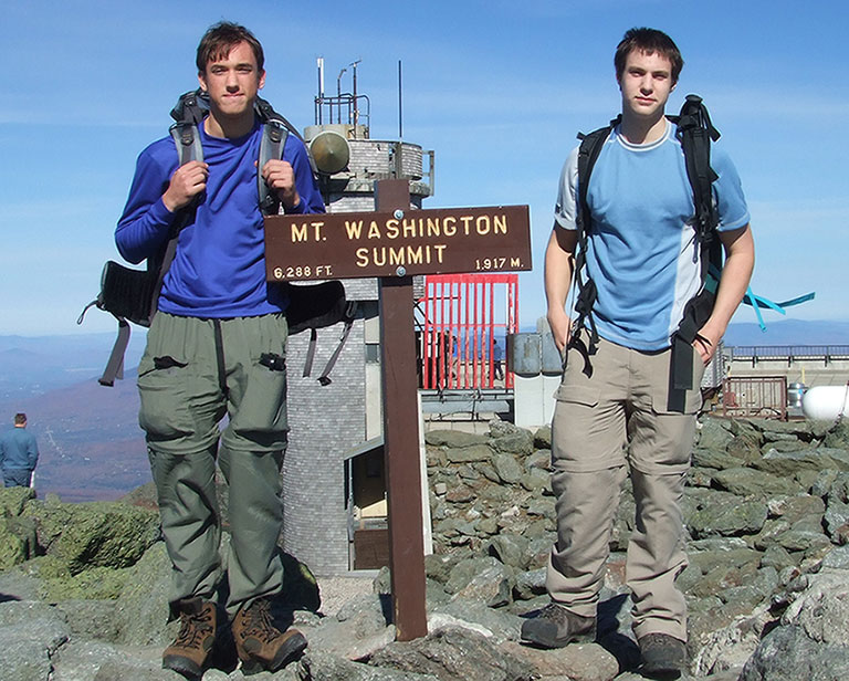
set off up the Tuckerman’s Ravine Trail. The kids tired of waiting for the
adults and were soon gone off ahead, not to be seen again until the summit.
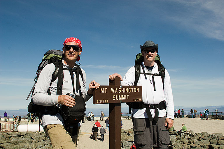
The entire round trip took us 10 hours 37 minutes and my heart rate monitor
recorded that I burned 3,291 calories. We spent an hour at the top and lost
another on a initial wrong turn on the descent, so figure 8 1/2 hours round trip
actual hiking time. This was in good weather; bad weather would obviously have
made things more difficult.
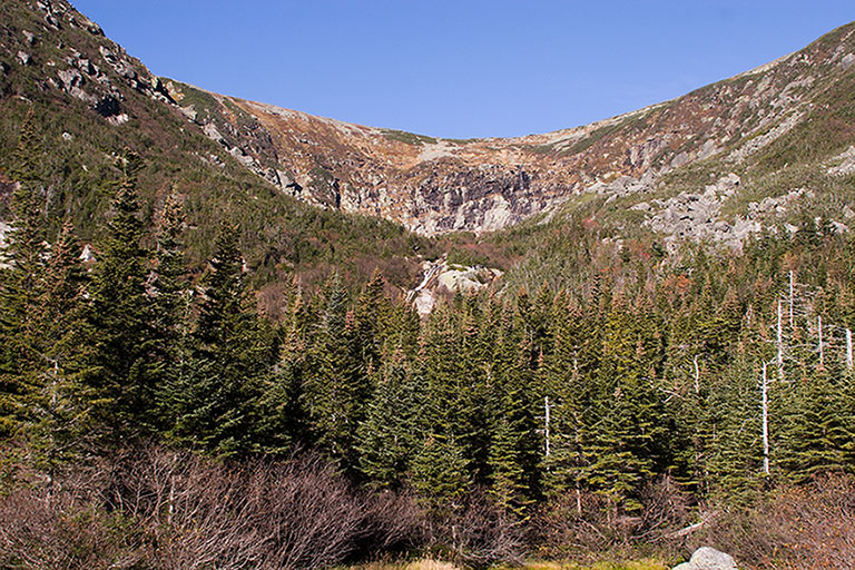
Tuckerman’s Ravine is the famous site of spring skiing in New England, with snow
lasting sometimes until July. Skiers pack camping gear (my summer pack weighed 42 lbs)
plus their skiing equipment on their backs and tramp up the same route we took
to the top using crampons and ice axes, and then ski down. I have a lot of
respect for the extreme physical conditioning these folks have because we were
much more lightly laden and we did not have to contend with snow.
The hike to Hermit Lake is not difficult, over boulders on a fairly wide path
that could almost be called a road for a couple of miles. As soon as the wide
bowls of the ravine came into sight, the trail ends and you have to use both
hands and feet to ascend some 2,000 vertical feet at a steep
grade over piles of boulders, up the "headwall".
The summit has been described as the ugliest of all the US highpoints and I do
not doubt it. Hundreds of cars drive up the 8 mile road, disgorging their
cigarette smoking passengers into a carnival of gift shops and restaurants. We
spent an hour or so resting and rehydrating.
We decided the take the Huntington Ravine trail down because it looked easier on
the map than Tuckerman’s which we had just come up but after we had put about
500 vertical feet behind us, we were lowering ourselves down some steep rock
faces when a very fit French Canadian met us coming up and informed us that he
had climbed Mt. Washington many times and in his view a descent via Huntington’s
Ravine was “out of the question”. So we clambered up out of the ravine and
traversed along the Alpine Garden Trail across the top of Huntington’s Ravine
until we came to the Lion Head trail. We probably burned an hour on this
misadventure.
Lion’s Head was no picnic but we were both very glad we had met that Frenchman.
At the bottom again, we checked into the Joe Dodge lodge (where we had made
reservations back in August) … a very comfortable bunkhouse. We had a full
dinner at the Pinkham Notch visitor center right next door, showered back at Joe
Dodge and then fell into bed. The whole experience is exactly what you would
expect of a New England weekend: cheerful, fit people with their kids creating a
convivial atmosphere in the woods.
|
|
|
|
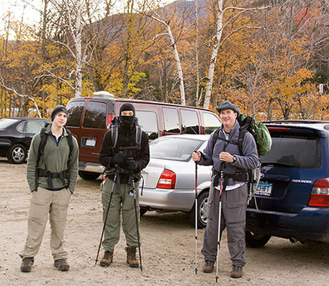
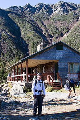
| 10th Mountain Ninja Division | Hermit Lake | Tuckerman's Ravine |
|
| ||
|
White Mountain Panorama | ||
|
|
|
|
|
|
|
|
Directions to Mt. Washington from Boston
US 1 North over the Tobin Bridge
I-95 North
Rt. 16 North to Pinkham Notch AMC visitor center

For George Fisher's main Highpoint page, click here
© Copyright George Fisher 2006 all rights reserved
| Please note that hiking and mountain climbing are
dangerous sports and many people are injured or killed every year
participating in these activities. The author is not responsible for
any misadventures resulting from the information provided on this
site. Anyone participating in these sports does so entirely at their own risk. |